Introduction
XCSoar is an Open Source software for tactical glide computer: run it on any PDA/Smartphone/eBook and you have a powerfull computer for sailplane, paradlider and hang glider. (see previous post about adding a GPS to an eReader)
Generated map can be downloaded here
The geo file format used by XCSoar are:
- elevation geotiff raster with altitude encoded (custom format)
- waypoints
- airspace
- any shapefile
We will use the latest to add custom geo referenced information on XCSoar (in this case, paragliding skyways from thermal.kk7)
Software requirement
Processing files
#remove and create temp folder for file processing
rm -rf tmp/; mkdir tmp/
#convert PNG+PGW to GeoTiff and resize for faster processing (resize to any % or none)
gdal_translate ./skyways_all.png tmp/skyways_all.tif -outsize 50% 50%
#vectorize contour to shapefile red layer
gdal_contour tmp/skyways_all.tif tmp/skyways_all_r.shp -i 50 -b 1
#vectorize contour to shapefile green layer
gdal_contour tmp/skyways_all.tif tmp/skyways_all_g.shp -i 80 -b 2
#vectorize contour to shapefile blue layer
gdal_contour tmp/skyways_all.tif tmp/skyways_all_b.shp -i 200 -b 3
Visualisation with QGIS
Import from Layer->Add Vector Layer and select your 3 files
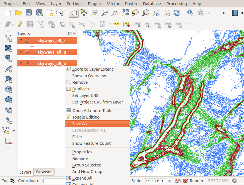
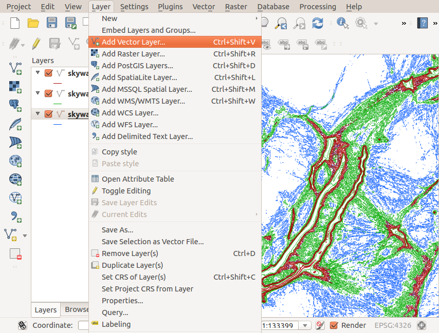 Then if everything is fine, save the 3 as Shapefiles:
Place the generated file into the XCM (XCSoar compressed archive map)
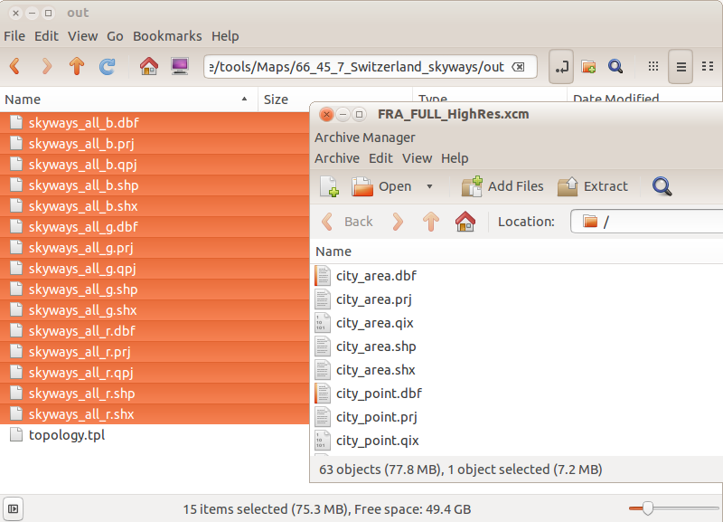 Dont forget to edit the topology.tpl to add the names of the new files:
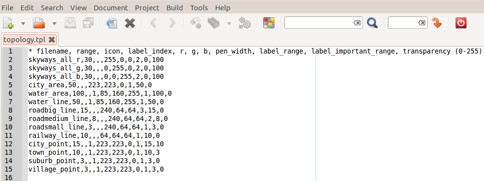 You can edit color (RGB, 0-255) and transparency (0-255)
The order is important: element are displayed from top to bottom (first to last)
Result
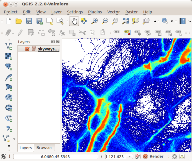
Original raster file, PNG + PGW format.
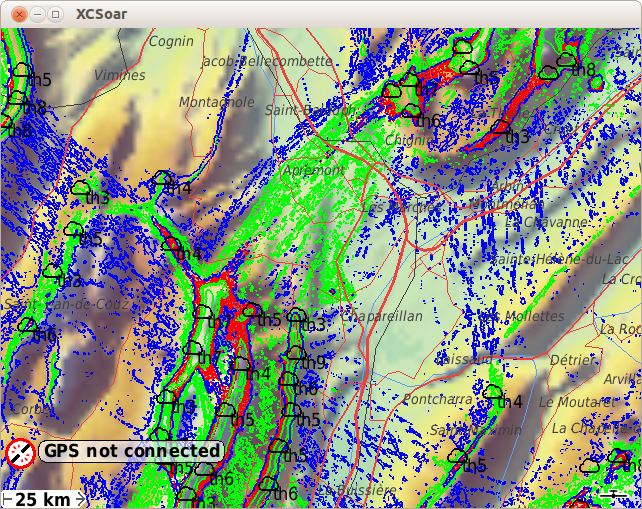
Generated shapefile maps in XCSoar (desktop version)
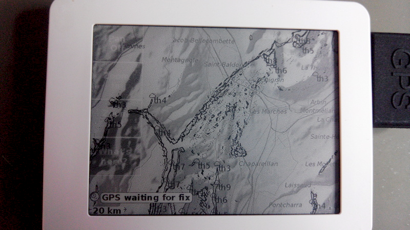
Same in XCSoar but eReader version optimised for black and white gray levels.
Generated map can be downloaded here

Hi,
I am a german gliderpilot using XCSoar.
I often have to switch my mapfile in XCSoar during flight. This is not so nice and I want to have only one mapfile in my XCSoar.
Looking for a solution I found your website. I am sorry not understanding all I read. But I hope you can give me a help.
How to merge some single maps into only one map for using in XCSoar?
I am using the XXX_HighRes.xcm maps.
Thank you very much
and best regards
EG
Hi! I would love to generate custom maps for my Kobo but I am not able to do this (lost brain cells in thermal air, I think)….
I´ve installed the QGIS-Software and I have Access to the GDAL library bit I don´t know what to do with the “processing files”. Do you have a YouTube tutorial or so? I Need a map of the Alps (Germany, Switzerland and Austria) with the skyways.
Thanks for your help!
Jerg
I would love to help you, but as it’s been 2 years now, I’m not very much in it and unfortunately I cannot give you any hint.
That’s why I made this documentation, in the hope it would be helpfull to someone. Maybe you should reach the XCS forum, they know generating map is PITA.
Hi, i am a paragliding pilot, i would like to get a map of central italy..
unfortunately there is no way to retreive skyways_all.png..
all you get is the tiles mosaic, and i am not so good ad puzzles..
There any way or procedure to get the raster file of the skyways?
Thanks
Please consider to add another map option in XCSOAR, not based on elevations but actual maps for navigation. I can not believe this is not already done, since xcsoar can only be considered an aviation navigation app????
I would like to import the Danish Copenhagen Area ICAO VFR map, to be used as a background in XCSOAR.
http://aim.naviair.dk/media/files/2sjc3o2nc5m/EK_Chart_ANC_COPENHAGEN_AREA_en.pdf
It could be any other georeferenced map, as log as a topographical map can be included, and then the elevation map can be hidden. It bringes almost no information, and the AGL can be calculated without it being displayed.
Please make this possible.
@True Kynda: does it look like this is the XCSoar issue tracker here?
You pick up information you are interested with and CONTRIBUTE with your own experience. Not a whining zone here!